AZAD KASHMIR
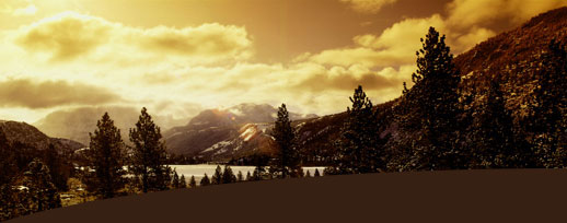
Azad Jammu and Kashmir (AJK) or, for short, Azad Kashmir(literally, "free Kashmir") is the southernmost political entity within the Pakistani-controlled part of the former princely state of Jammu and Kashmir. It borders the present-day Indian-administered state ofJammu and Kashmir to the east (separated from it by the Line of Control), the North-West Frontier Province of Pakistan to the west, the Federally Administered Northern Areas (FANA) to the north, and the Punjab Province of Pakistan to the south. With its capital atMuzaffarabad, Azad Kashmir covers an area of 13,297 km² (5,134 mi²) and has an estimated population of about four million.
Azad Kashmir's financial matters, i.e., budget and tax affairs, are dealt with by the Azad Jammu and Kashmir Council, rather than by Pakistan's Central Board of Revenue. The Azad Jammu and Kashmir Council is a supreme body consisting of 11 members, six from the government of Azad Jammu and Kashmir and five from the government of Pakistan. Its chairman/chief executive is the president of Pakistan. Other members of the council are the president and the prime minister of Azad Kashmir and a few other AJK ministers.
History

After the Partition of India in 1947, the princely states were given the option of joining either India or Pakistan. However, Hari Singh, the maharaja of Jammu and Kashmir, wanted Jammu and Kashmir to remain independent. In order to buy some time, he signed a stand-still agreement, which side-stepped the agreement that each princely state would join either India or Pakistan. The raiders from North-West Frontier Province and the Tribal Areas feared that Hari Singh may join Indian Union. In October 1947 supported by Pakistani Army they attacked Kashmir and tried to take over control of Kashmir. Initially Hari Singh tried to resist their progress but failed. Hari Singh then requested Indian Union to help. India responded that it could not help unless Kashmir joins India. So on 26 October 1947 Kashmir accession papers were signed and Indian troops were airlifted to Srinagar. Fighting ensued between Indian Army & Pakistani Army with control stabilizing more or less around what is now the "Line of Control".

Later, India approached UN to solve dispute & resolutions were passed to hold a plebiscite with regard to Kashmir's future. However this plebiscite has not been held on either side since the legal requirement for the holding of a plebiscite was the withdrawal of the Indian and Pakistani armies from the parts of Kashmir that were under their respective control--a withdrawal that never did take place. . In 1949, a cease-fire line separating the Indian- and Pakistani-controlled parts of Kashmir was formally put into effect. After the Indo-Pakistani war of 1971, that line changed significantly in a few areas, and the new line, which was formally agreed to in 1972, was designated as the "Line of Control," separating the Indian and Pakistani forces and the Indian- and Pakistani-controlled parts of the former princely state.
The Line of Control has remained unchanged since the 1972 Simla pact, which bound the two countries "to settle their differences by peaceful means through bilateral negotiations." Some political experts claim that, in view of that pact, the only solution to the issue is mutual negotiation between the two countries without involving a third party, such as the United Nations.
Following the 1949 cease-fire agreement, the government of Pakistan divided the northern and western parts of Kashmir which it held into the following two separately-controlled political entities:
- Azad Jammu and Kashmir (AJK) - the narrow southern part, 250 miles (400 km) long, with a width varying from 10 to 40 miles (15 to 65 km).
- Federally Administered Northern Areas (FANA) - the much larger area to the north of AJK, 72,496 km² (27,991 mi² ), directly administered by Pakistan as a de facto dependent territory, i.e., a non-self-governing territory.
An area of Kashmir that was once under Pakistani control, but is no longer, is the Shaksgam tract--a small region along the northeastern border of the Northern Areas that was provisionally ceded by Pakistan to the People's Republic of China in 1963 and which now forms part of China's Uygur Autonomous Region of Xinjiang.
Dispute Positions
According to Pakistan's constitution, Azad Kashmir is not part of Pakistan, and its inhabitants have never had any representation in Pakistan's parliament].As far as the United Nations is concerned, the entire area of the former princely state of Kashmir, including Azad Kashmir, remains a disputed territory still awaiting resolution of the long-standing dispute between India and Pakistan. In 1950, the government of India, held local assembly elections in Indian administered Kashmir and regarded the outcome as a referendum by which in 1956, unilaterally reorganised that portion of the former state that was under its control, thereby making that portion an integral part of India. The government of Pakistan, on the other hand, continues to this day to regard the entire area of the former state as "territory in dispute" to be resolved by a plebiscite to be held at some future date, in order to determine the entire area's accession to either India or Pakistan. While continuing to call for that plebiscite, however, the government of Pakistan has, so far, been unwilling to entertain the idea of a third option for the plebiscite, i.e., a choice of independence for the entire former state. Today, Azad Kashmir and FANA are together referred to by India as "Pakistan-occupied Kashmir" (POK) and, conversely, the present Indian-administered state of Jammu and Kashmir is referred to by Pakistan as "Indian-occupied Kashmir."
Government
Azad Jammu and Kashmir (AJK) is a self-governing state under Pakistani control but is not constitutionally part of Pakistan. It has its own elected president, prime minister, legislature, high court, and official flag. The government of Pakistan has not yet allowed the state to issue its own postage stamps, however, and Pakistani stamps are used in the state, instead. The state is administratively divided into two divisions which, in turn, are divided into eight districts.
| Division | District | Area (km²) | Population (1998) | Headquarters |
|---|---|---|---|---|
| Mirpur | Bhimber | 1,516 | 301,633 | Bhimber |
| Kotli | 1,862 | 563,094 | Kotli | |
| Mirpur | 1,010 | 333,482 | Mirpur | |
| Muzaffarabad | Muzaffarabad | 2,496 | 638,973 | Muzaffarabad |
| Neelum | 3,621 | 106,778 | Athmuqam | |
| Poonch | Poonch | 855 | 411,035 | Rawalakot |
| Bagh | 1,368 | 393,415 | Bagh | |
| Sudhnati | 569 | 334,091 | Pallandari | |
| AJK total | 8 districts | 13,297 | 2,972,501 | Muzaffarabad |
Ethnic Groups
Languages
Urdu is the official language of Azad Kashmir but is spoken by only a minority of people. The dominant language spoken in the state is Pahari, which is very similar to Pothwari and Hindko.
Economy
In the latter part of 2006, billions of dollars for development were mooted by international aid agencies for the reconstruction and rehabilitation of earthquake-hit zones in Azad Kashmir, though much of those funds were subsequently lost in bureaucratic channels, leading to delay in help reaching the most needy, and hundreds of people are still living in tents. A land-use plan for Muzaffarabad city was prepared by the Japan International Cooperation Agency.
Contact
Search site
Our Team

sajjad sarwar sahhar
EXETIVE OF SITE NAME: SAJJAD SARWAR EDUCATION: ...
—————

SHAFIQUE-UL-REHMAN
Project manager: Phone: +92-344-55 97 0 97 E-mail: sajjad_sarwar@graduate.org
—————

NOOR ALAM
seniour user: Phone: +92-344-55 97 0 97 E-mail: noor4450@yahoo.com
Portfolio
Reference #1
This is a description of the example reference. You can edit or remove it.
—————
Reference #2
This is a description of the second example reference.